|
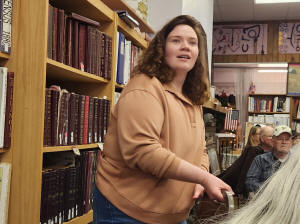
At the February 2026 Logan County
Genealogical and Historical Society meeting, Anna Sielaff hosted a
presentation titled “Relive the True Mother Road: the Edwards Trace
and how Illinois developed before it became a state.”
Sielaff, who was born and raised in
Lincoln, is the local history librarian at the public library in
Springfield. She works in the Sangamon Valley collection, which is
their local archive. This collection covers Sangamon County and
surrounding counties such as Logan County. Sielaff recently became a
Rhodes scholar and during the 250th anniversary of the United States
this year will travel throughout the state doing programs. Besides
Edwards Trace, she also does a program on women’s baseball.
Since she was 13 years old, Sielaff has been researching Edwards
Trace. Her goal for the program was to give everyone a broad
perspective of how Illinois developed before and after it became a
state in 1818.

Illinois has a rich history not
many people know about. For instance, Sielaff said when we think
about the colonial era, some of us think about the East Coast. We
have to remember though there were actually Europeans here in the
area before the 1700s.
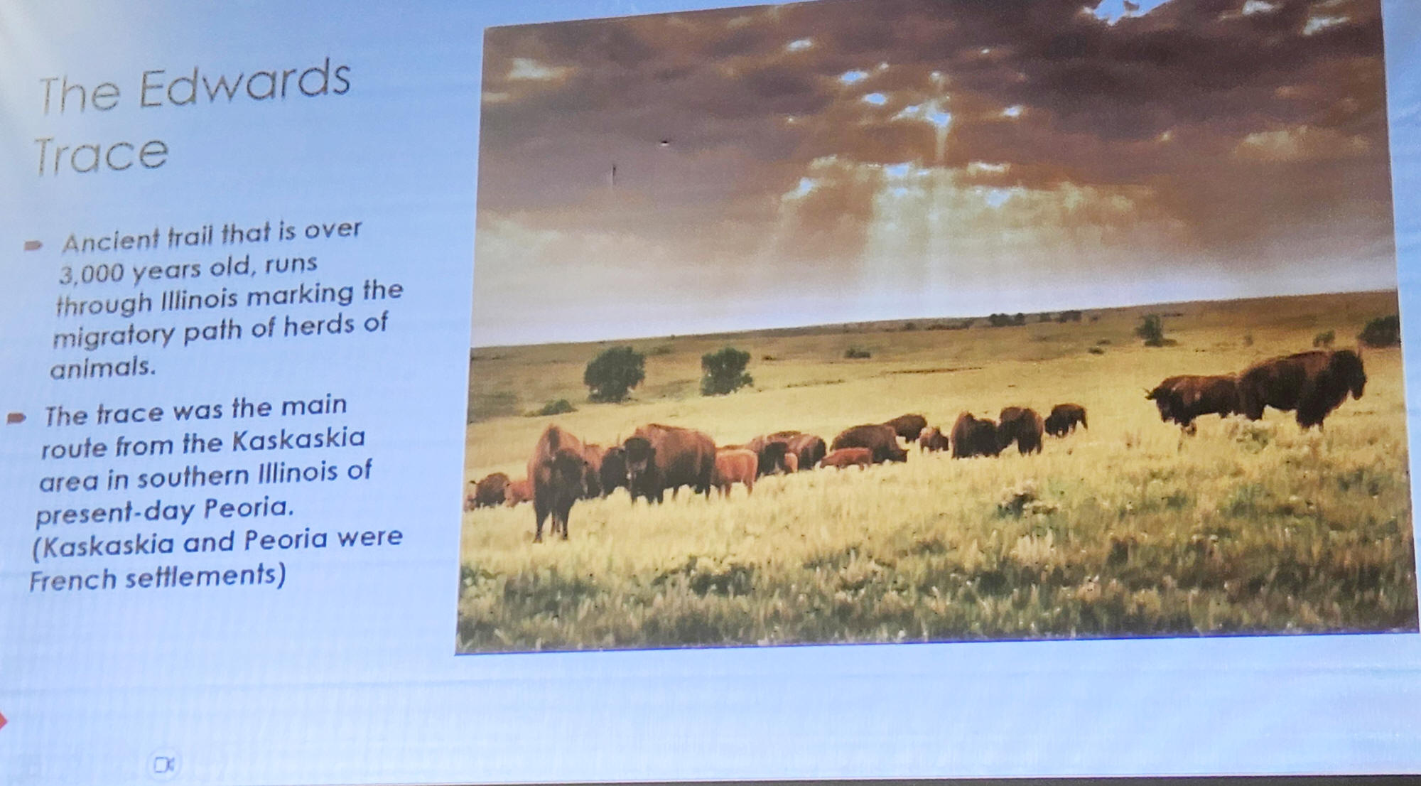
The Edwards Trace is ancient trail
that is over 3000 years old and runs through Illinois marking the
seasonal migratory path of herds and animals. It was used by the
Native Americans to follow the migrations and hunting, trade and
war. The Trace was the main route from Kaskaskia in Southern
Illinois to present day Peoria. Both Kaskaskia and Peoria were
French settlements. Sielaff called Edwards Trace the “Route 66” of
its time.
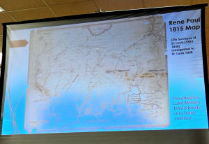
As an archivist, Sielaff loves
looking at old maps. An 1815 map of the Illinois Territory made by
St. Louis city surveyor Rene Paul shows the Edwards Trace starting
near Edwardsville and going up to Lake Peoria.

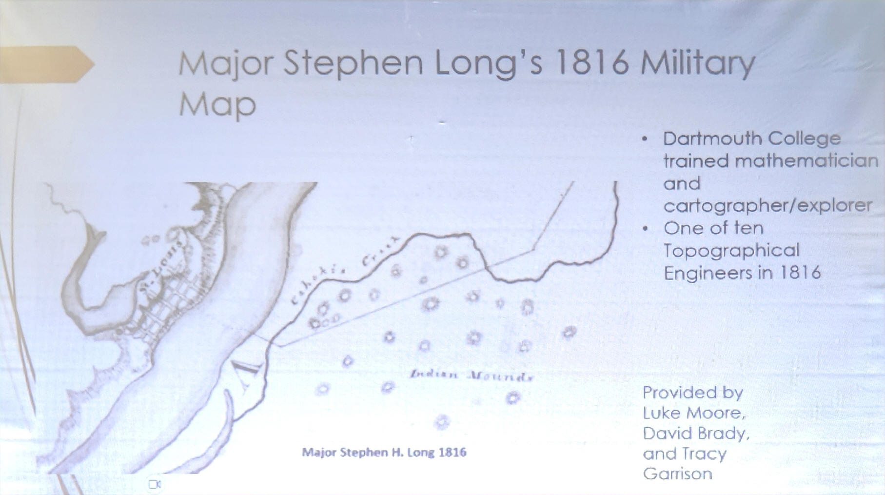
An 1816 military map by Dartmouth
College’s trained mathematician and cartographer/ explorer major
Stephen Lang also shows parts of Edward’s Trace. Lang was charged
with looking at the fortifications in the Illinois territory and
seeing how improvements could be made. On his travels, he passed
Edwards Trace and the Cahokia Mounds.
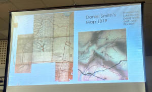
In addition, Daniel Smith’s 1819
map has dotted lines with towns like Elkhart labeled. Smith was
involved in the Kickapoo Treaty deliberations in Edwardsville when
he drafted this map to show landmarks the Kickapoo would recognize.
Sielaff said the dotted lines show Edward’s Trace near Elkhart.
These maps are great primary documents showing the existence of the
Edwards Trace.

There were many native tribes in
the area in the 17th and 18th centuries. The 17th century native
tribes in Illinois were the Illinois also known as the Illiniwek
confederation and a group of tribes that included the Peoria,
Kaskaskia, Tamaroa and Michigamea. Sielaff said they shared similar
languages and customs. The 18th century native tribes in Illinois
included the Sauk, Fox, Kickapoo, Miami and Powatami tribes.
Sielaff said Native Americans used the trail because it provided an
easier way to travel during the harsh winter conditions when the
lakes were frozen. The trail was still accessible. The path from
Edwardsville to Peoria was about 146 miles long.
To explain the difference between a trace and a trail, Sielaff said
a trace is a mark left by someone or something so it could be a path
trail footprint or sign of something that existed years ago. A trail
is used specifically to refer to a path that someone took.
In the 17th century, French
explorers Jacques Marquette and Louis Joliet travelled the
Mississippi River hoping to find a waterway that emptied into the
Pacific Ocean. Sielaff said they followed the Mississippi to
Arkansas and that opened the area to other French explorers and fur
traders.
[to top of second column] |

The French were
the first Europeans in Illinois to contact Native Americans, and
the first to govern the land and build forts. The French
established missionaries in Cahokia in 1699 and Kaskaskia in
1703, which Sielaff said makes them the oldest towns in Illinois
These French explorers established outposts by the Mississippi
River while seeking a route to the ocean and looking for gold
and other riches as they travelled south. Sielaff said they
instead found good soil, which is now know the American bottom,
a fluvial plain between the Mississippi River and the cliffs
where Kaskaskia is located.
Fort De Charles in Prairie De Rocher is the first French
settlement built in southern Illinois. Sielaff said it was the
French headquarters but never saw battles. It was built as a
symbol to show French power.
French Cahokia, the Cahokia courthouse and the 1799 Church of
the Holy Family are places still standing in Cahokia, Illinois.
All the priests who preached there are buried behind the church.
Archeologist and historian Robert Mazrim did extensive research
on the Edwards Trace. Mazrim talked about recognizing the
importance of trails, especially ones linking French villages to
the American bottoms.
French and Indian War links to Edwards Trace
In 1778 George Rogers secured Kaskaskia for the United States.
During the Revolutionary War, Sielaff said Kaskaskia was still
populated by French settlers and Clark’s victory doomed British
control there when he captured the British headquarters. He
travelled a portion of the Edwards Trace when he travelled from
Kaskaskia to Cahokia. British officer Henry Hamilton called for
a counterattack at Kaskaskia. His travels led him from Fort
Detroit in Michigan to Vincennes, Indiana.
The western liberty bell, given by King Louis IV to the Catholic
Church in in the Illinois County was rung in Kaskaskia to
celebrate after Clark captured the town July 4th, 1778. Sielaff
said this bell is still rung every July 4th
Kaskaskia was the first state capital. In 1993, Kaskaskia was
ravaged by flood.

French called the area Kaskaskia
Cahokia trail in the 1700s and this trail is still travelled 300
years later. Ninian Edwards, who was a legislator judge and then
territorial governor of Illinois in early 1800s, is where Edwards
Trace got its name. It was Edwards who oversaw Illinois’ transition
into statehood. Sielaff said Edwards was married to Mary Todd
Lincoln’s sister, so there was a connection to Abraham Lincoln
The War of 1812 involved disputes over shipping rights on the open
seas. It was known as an Indian war as it pitted Native Americans
loyal to British against the Americans settlers.
Sielaff said in an attack at Fort Dearborn near Chicago, 66 American
settlers and 15 Potawatomi died. Potawatomi tribe member Black
Partridge supported the white settlers and saved many settlers
during the attack. Tensions between the Kickapoo and the Potawatomi
were high.
A massacre at Fort Dearborn prompted Edwards to form a militia of
rangers to take the trail to attack the Potawatomi Indians. Sielaff
said when Black Partridge saw damage to his village, he and his
tribe attacked Fort Russell.
After this campaign, the trail was named in honor of Edwards and
became the main route of travel from the north to the south. Even
now it goes near Springfield and Lincoln.
Nearby connections to Edwards Trace
Sielaff said James Latham, who was the first white Logan County
settler, purposefully put his family farm near the Edwards Trace on
Elkhart hill.
An 1819 map shows Kickapoo village in Lincoln. In 1790, in what is
now Memorial Park in Lincoln, the Gilham family wife and children
were abducted by the Kickapoo and taken all the way to Kickapoo
town. Anne Gilham is reported to have been the first Caucasian woman
to lay eyes on Logan County. Sielaff said an 1815 map shows Kickapoo
town along Edwards Trace. Trail trees were flexible saplings that
give directions as people traveled and one can be found in Memorial
Park in Lincoln.
Other Illinois areas on or near Edwards Trace include Robert
Musick’s home, a trail near Hartsburg, Buffalo Hart and Lake
Springfield. At Lake Springfield, Sielaff said there is this
historical marker noting Edwards Trace.
Zimri Enos said a trail or trace as an interesting matter of history
should be established before all evidence of its location is gone.
Unfortunately, the trace is in danger of being destroyed.
Over 20 years Luke Moore, David Brady and Tracy Garrison have been
studying Edward's Trace and using LIDAR to find sections of it.
Sielaff has created an interactive story and website to share some
of the information she has found. To learn more, contact her at
annasielaff98@gmail.com
LCGHS Edwards Trace Presentation photo slideshow
[Angela Reiners] |